Adarsh Palm Acres Location
Adarsh Palm Acres is located at Vidya Nagar Cross Road, BEML Layout, North Bangalore. The project is close to the Kempegowda International Airport (10.5 km), Hebbal (20.4 km), and Yelahanka (11.4 km). The nearest Metro station is Doddajala, located about 6.2 km away.
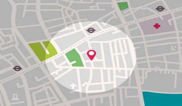
The Google Plus code of the Adarsh Palm Acres Location Map is 5M47+WHG. It has a latitude of 13.162123 and a longitude of 77.663328.
The project enjoys a key location near the major IT hubs of Mayanta Tech Park, with seamless access to the best colleges, shopping centres, schools, malls, and other important city landmarks.
Location and Land Details
- Project Survey Numbers: SY. NO. 60/1, 60/2, 60/3, 60/4P, 61, 111/1, 111/2, 111/6, 112/1, 112/2, 122/1, 122/2, 122/3, 123/1, 123/2, 123/3, 123/4, 126/1, 126/2, 126/3, 127, 128P, 129/P, 130/1P, 131/1, 171, 172, 173, 174, 175, 176 & 177
- Village: Huttanahalli Village
- Taluk: Bangalore North
- District: Bangalore Urban
- PIN Code: 562157
Boundary Details of Adarsh Palm Acres Site
- North: Public Road
- South: Sy No. 128/1 and 132/3
- East: Village Boundary
- West: Sy No. 58, 59, 72P, 138/1
Adarsh Palm Acres Address

The exact address of Adarsh Palm Acres is at Jala, Hobli, Vidya Nagar Cross Road, BEML Layout, Huttanahalli, North Bangalore, Karnataka 562149. This address is registered under Bangalore North Taluk in Bangalore Urban district. The address’s latitude is 13.162123, and its longitude is 77.663328.
Adarsh Palm Acres Connectivity

Adarsh Palm Acres location is in Bagalur, which is one of the major areas of Bangalore with excellent connectivity. The project location is an important zone in North Bangalore that has easy access to all modes of transport via road, rail, metro, and air. It is connected to all major areas of the city through a network of roads, including NH 44, NH 648, SH 104, and Bagalur Main Road.
Road Connectivity

The project location is connected well to all areas through the Outer Ring Road, main roads, and highways. There are BMTC buses throughout the day near the project location, which makes it easy for residents to reach to all the needed areas of Bangalore.
Nearby BMTC bus stops
- Bagalur Bus Stop – 3.4 km
Metro Connectivity

Adarsh Palm Acres has easy access to the major stations of the Metro. The closest Metro Station to this project location is the upcoming Doddajala Metro Station. This station is marked under the Blue Metro Line that connects Central Silk Board to the Airport.
Closest Metro Station
- Doddajala Metro Station – 6.2 km
Rail Connectivity

The project offers very easy access to major city railway stations, which makes travel to all cities in India easier. The nearest railway station enables people to reach all neighbouring states in a short time.
Nearest Railway Station
- Yelahanka Railway Station – 13.1 km
Air Connectivity

Residents of Adarsh Palm Acres can use New Airport Road to get to Kempegowda International Airport. The project location is only a 15-minute drive from the Bangalore airport via New Airport Road.
- Kempegowda Airport – 13.1 km
Places to visit near Adarsh Palm Acres
Adarsh Palm Acres is located in North Bangalore, which is close to parks, nature spots, and cultural places. Many places are good for weekend trips, as follows,
Skandagiri Hills – 41.5 km

Skandagiri Hills is a 1,350-meter-high mountain fortress. It is known for its sunrise treks above the clouds. It has 18th-century Tipu Sultan fort ruins. It also has an 8 km round-trip trek that will take 6-8 hours to finish.
- Timings: 5:30 AM – 12:00 PM
- Entry Fee: ₹250 per adult and ₹125
Nandi Hills – 36.9 km

Nandi Hills is an ancient fortress built by the Ganga dynasty. It is known for its scenic views, and people visit early in the morning to enjoy sunrise views. The misty viewpoints make it one of the best places to visit.
- Entry Fee: Rs. 30 per person
- Timings: 6:00 AM till 6:00 PM
Devanahalli Fort – 18.7 km

Devanahalli Fort is a grand citadel and a historic site built in the 18th century. It is the birthplace of Tipu Sultan and has wide open spaces. The fort was a crucial military base against the British East India Company.
- Timings: 7:00 AM – 7:00 PM
- Entry Fee: Free
Hebbal Lake Park – 21.6 km

Hebbal Lake Park is a green space with a canopy of trees, a kids' play area, lawns, and benches. It is ideal for evening walks and a perfect spot for nature lovers.
- Timings: 6:30 AM – 6:00 PM
- Entry Fee: Rs. 10
Jakkur Lake – 14.9 km

Jakkur Lake is one of the biggest lakes and a peaceful place surrounded by greenery. It is popular for bird watching and nature walks.
- Timings: Open Fully
- Entry Fee: Free
Bagalur
Bagalur is a town located in the northern part of Bangalore. It is known for its proximity to the Airport and major IT hubs like Aerospace Park and Manyata Tech Park. As a result, the real estate market in the area is growing rapidly. Bagalur is more affordable compared to nearby areas and is preferred by many homebuyers due to its growth potential and connectivity.
Bagalur and its Connectivity
Bagalur has access to all modes of transport like bus, metro, and rail, allowing hassle-free commuting. The area is connected by NH 44, SH 104, and Bagalur Main Road, which provide easy access to all parts of the city. BMTC buses and cabs are widely available. The ongoing metro extension of the Airport Line is expected to boost property value in the future.
Bagalur Road Connectivity
Bagalur Road offers seamless access to nearby bus stands, metro stations, IT companies, and the airport.
National Highways
- NH 44
- NH 648
State Highways
- SH 104
Major Connecting Roads
- Reva College Road
- BK Halli Road
- Bagalur Main Road
- Bagalur–Sarjapur Road
Bagalur Metro Connectivity
Bagalur has metro access through the Blue Line, connecting it to various parts of the city. The upcoming Airport Metro Line will further improve connectivity with direct access once completed.
Bagalur Airport Connectivity
The closest airport is Kempegowda Airport, which can be reached via Airport Road. It allows residents to reach the airport within 15 minutes.
Major Tech Parks Near Adarsh Palm Acres
- KIADB Hardware Park - 3 Kms
- Shell Technology Centre - 4 Kms
- Amazon, Airport Road - 8 Kms
- North Gate Tech Park - 9 Kms
- Philips Innovation Campus - 10 Kms
- Manyata Tech Park – 15.3 km
- Kirloskar Tech Park – 16 km
Major Hospitals Near Adarsh Palm Acres
- Cytecare Hospitals, Airport Road - 9 Kms
- Manipal Hospital - 10 Kms
- Sparsh Hospital - 12 Kms
- Sparsh Hospital - 15 Kms
- Rainbow Children's Hospital - 15 Kms
- Motherhood Hospital - 16 Kms
- Manipal Hospital, Hebbal - 17 Kms
- Aster CMI Hospital - 17 Kms
Entertainment Near Adarsh Palm Acres
- Acres Bengaluru - 6 Kms
- Bhartiya Mall Of Bengaluru - 11 Kms
- BYG Brewski - 11 Kms
- The Galleria Mall - 12 Kms
- Mall of Asia - 15 Kms
Educational Institutions Near Adarsh Palm Acres
- Sri Venkateshwara College of Engineering (SVCE) - 3 Kms
- The School of Raya - 5 Kms
- Delhi Public School - 6 Kms
- Sir M. Visvesvaraya Institute of Technology - 7 Kms
- REVA University - 7 Kms
- Stonehill School - 9 Kms
- Ryan International School - 10 Kms
- Canadian School - 11 Kms
- National Public School, Jakkur - 13 Kms
- Nitte Meenakshi Institute of Technology - 11 Kms
- Manipal Academy of Higher Education - 11 Kms
Key Distances From Adarsh Palm Acres to Main Areas
- Yelahanka - 11.4 km
- Nagawara - 21.1 km
- Hebbal - 20.4 km
- Devanahalli - 17.8 km
FAQs
1. Where is Adarsh Palm Acres?
The project is in Bagalur, North Bangalore.
2. What are the location coordinates of the project?
The latitude is 13.162123° N and the longitude is 77.663328° E.
3. Which is the major landmark near Adarsh Palm Acres?
The project is near Aerospace Park.
4. What is the Google Plus code of Adarsh Palm Acres?
The Google Plus code of the project is 5M47+WHG.
5. What is the pin code of Adarsh Palm Acres?
The pin code of Adarsh Palm Acres is 562157.